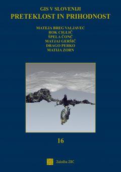
Preteklost in prihodnost
The book Preteklost in prihodnost ('The past and the future') is the sixteenth volume in the GIS v Sloveniji (GIS in Slovenia) book series and commemorates its 30th anniversary. The goal of the volume is to present the wide variety of research findings on geographical information systems in Slovenia in recent years. Powerful geoinformatic tools and precise data facilitate research on processes and phenomena, and their modelling. The volume presents project outputs and research results in areas such as geology, geomorphology, hydrology, pedology, agriculture, natural disasters, environmental protection, geography, surveying, archaeology, transport, telecommunication infrastructure, tourism, cultural heritage, education, cartography, geographical names, remote sensing, and others. Readers discover new features regarding the applicability of geographical information systems and learn about interesting research findings in many areas.
Chapters
-
Geographic information systems in Slovenia between 1992 and 2022
-
Anisotropy of karstic surface with directional semivariograms from digital relief model
-
Determining the geomorphological and hydrogeological connections between dolines and the cave polina peč using 3D laser scanning
-
Modelling soil water erosion in Slovenia
-
Assessment of organic carbon sequestration in the soil of agricultural land in Slovenia
-
Seasonal influence of rainfall on landslides until the middle of the 21st
-
Determining potential avalanche triggering areas by relief analysis
-
Use of satellite imagery for monitoring the water potential in vineyards
-
Height Above Nearest Drainage (HAND) – dataset for Slovenia
-
Plenjenje evrazijskega risa (Lynx lynx) in mikrohabitatne reliefne značilnosti: primer analize morfometrije in morfologije vrtač kot lokacij uplenitev parkljarjev
-
Functional regions of upper secondary education in Slovenia
-
Web-based traffic signalisation databank application of traffic signalisation on Slovene national roads – WEPS
-
Influence of method selection on the calculation of public passenger transport stops accessibility
-
GIS as a tool for coverage analysis of electric vehicles charging stations in Slovenia
-
Quantitative categorisation of mountain trails in selected areas in the Kamink–Savinja Alps
-
The spatial analysis of mobility flows of Marie Skłodowska-Curie Action Fellowship Program fellows in Europe
-
Atlas on Quality of Life in Slovenia as a tool for supporting decision-makers in regional and local development
-
Field measurements of 4G mobile networks
-
DRAJV mobile application as an example of telematics and GIS usage in insurance
-
Geodetic determination of the Rapallo border, its digitisation and intersectionwith the historical and current state of the land cadastre
-
Development and use of geographic information systems at the Surveying and Mapping Authority of the Republic of Slovenia
-
Topographic database (DTM)
-
Flai.ai – web application for automatic classification of point clouds
-
Roof orientations of the existing building stock in Slovenia
-
Land cover classification using deep learning on PlanetScope time series data
-
Collecting voluntary photographs of topographic changes and the analysis of their usefulness
-
Standardization of hydronyms in Slovenia and geographic information systems
-
Front / Back
Downloads

Series
License

This work is licensed under a Creative Commons Attribution-NonCommercial-NoDerivatives 4.0 International License.
