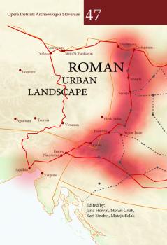
Roman urban landscape. Towns and minor settlements form Aquileia to the Danube
A book presents new elements of the urbanistic aspects of Roman towns and minor settlements in the large area of Caput Adriae, Noricum, and Pannoniae. The result of these efforts is twenty-six contributions by 54 authors from eight countries (Austria, Slovenia, Italy, Croatia, Hungary, Serbia, Montenegro, North Macedonia). With this publication, we have attempted to expand the knowledge about the development of towns and some other important settlements and their integration into a larger network of urban and rural agglomerations.
The initial two articles present broader but different perspectives on urbanisation. In the next part, twenty-two settlements are discussed. The extreme north-east of Regio X is represented by four settlements (Aquileia, Tergeste, Emona and Nauportus). The book includes most of the autonomous towns in Noricum as well as some other settlement areas (Celeia, Flavia Solva, Virunum, Magdalensberg, Teurnia, Aguntum, Iuvavum, Ovilava, Lauriacum, Stein). Selected towns and minor settlements are presented from the provinces of Pannonia Superior (Vindobona, Carnuntum, Strebersdorf, Savaria, Poetovio, Aquae Iasae) and Pannonia Inferior (Mursa, Bassiane).
The book offers the most important results of mainly large research groups. Two research strategies stand out in particular, with which it was possible to record comprehensive data on large or even massive ancient settlements. Systematic and large-scale geophysical surveys have provided excellent insight into areas that were not built on in modern times. These surveys are combined with various other methods such as aerial photography, LiDAR images, surface surveys and archaeological excavations (e.g., Carnuntum, Flavia Solva, Stein, Teurnia). In modern, heavily built-up areas, however, researchers relied mainly on the accurate recording and mapping of all kinds of archaeological evidence, from chance finds to preventive excavations. After several decades, this tedious and laborious work led to rich results (e.g., Ovilava, Iuvavum, Celeia, Mursa, Emona, Aquileia). In most cases, however, combining all possible traditional and modern methods enabled an enormous increase in knowledge.
The area is located in the contact zone between the eastern and western halves of the Empire and encompasses parts of the three geographical areas (i.e., the Mediterranean, Alpine and Continental worlds), which could make the book interesting for a broader understanding of the functioning of the Roman Empire.
Chapters
-
Front / Back
-
Urbanisierung – Romanisierungspolitik oder Ergebnis von administrativer Organisation und Urbanität durch politisch-sozialen Wandel? Die Stadt als strukturelles Erfolgsmodell
-
The urban corridors of Roman Pannonia
-
Regio X
-
Aquileia and its urban development in the light of recent and ongoing research
-
Urbanistic studies in Aquileia
-
L’impianto urbano di Tergeste: nuovi dati e riletture
-
Nauportus / Vrhnika
-
Archaeological research of Emona in the period 2000–2022New findings about the urbanistic development of the Roman town and previous military use of the area
-
Noricum
-
Municipium Claudium Celeia
-
Oppidum Solva und Municipium Flavia Solva (Noricum)
-
Forschungen im norisch-römischen Zentralraum Magdalensberg-Zollfeld 2002-2022
-
Teurnia/St. Peter in HolzMunicipium et metropolis inter Alpes
-
Municipium Claudium Aguntum
-
Municipium Claudium Iuvavum. Versuch einer aktuellen Bestandsübersicht
-
Ovilava, das römische Wels, im Lichte der Forschungsergebnisse der vergangenen 20 Jahre
-
Circum Lauriacum. Forschungen zum zentralen Knotenpunkt am norischen Donaulimes
-
Das hippodamische Straßensystem im Lagerdorf des Auxiliarkastells in Stein/St. Pantaleon-Erla
-
Der Legionsstützpunkt Lauriacum/Enns. Siedlungsstruktur – Gräberfelder – Siedlungsentwicklung
-
Pannonia Superior
-
Vindobona – Legionsstandort und Municipium
-
Carnuntum – Eine antike Siedlungsagglomeration an der mittleren Donau
-
Der nordwestpannonische Vicus Rhispia (Strebersdorf-Frankenau) an der Bernsteinstrasse
-
Savaria in BewegungTopografische Forschung im südlichen Gebiet von Savaria
-
Latest research in Poetovio
-
Recent discoveries in the sanctuary area of the Roman settlement Aquae Iasae (Varaždinske Toplice)
-
Pannonia Inferior
-
Aelia Mursa reimaginedA comprehensive study of urban evolution through archaeological insights
-
Bassianae – a reassessment of epigraphic evidence
Downloads

Series
License

This work is licensed under a Creative Commons Attribution-NonCommercial-ShareAlike 4.0 International License.
